Sunday, October 18, 2009

Kilpatrick Hills

Time for a local jaunt, no need to sit hours in the car, we started at Milngavie, the plan to Head over the Kilpatrick Hills in a loop-like route.


We blagged this route off a What-Mountain-Bike magazine coverdisk, so you would of thought the trail would of been well marked, but it fell a bit short at the end.

The first section from Milngavie to Hardgate is good, head over past Craigtown school to Cochno road, nice bits of wee ST and riding over fields to get the legs warmed up. Just as well, cause the pull up to Greenside reservoir takes its toll. From there you need to get to Loch Humphrey, there are some trails marked just be careful in your choice. Quite boggy riding but certainly easy enough to find your way (hint:follow the pylons).

From Humphrey to Lily you follow a fairly muddy trail, look for the intersection of the stone walls, and don't try and head over Duncolm hill. Stick left. Once past Lily loch the route to Burncrooks is poor at best, heavy riding over boggy moorland. Lots of falling off been done as the front wheels got sucked down. After Burncrooks its standard fire-road trail back onto the WHW to head to Milngavie.

Piccies are here

Summary
Highlight: Down from Craigton to Hardgate
Lowlight: Lily to Burncrooks
Summary: Potential to be a cracker - but a touch too wet and Lily loch section brings it down.
Ride Rating: 6/10

Stats
Date: 17/10/09
Pedaling time: 4.5hrs
Distance: 19miles
Max speed: ?
Total ascent: ?
Total descent: ?
Puncture count: 0
Bike shop: Solid Rock Cycles
Cafe: Lots in Milngavie
Riders: DH,RI, SC

Driving from Glasgow
Distance: 10 miles
Travel time: 15mins
Directions: Google Maps

Sunday, October 11, 2009

Kirroughtree

Finding myself down Dumfries way last week, I took the opportunity to pop along to one of the farthest from Glasgow 7 Stanes - Kirroughtree, the home of the infamous McMoab.

Now I had to hire a steed for this jaunt as I didnt take the Dawg with me, but there is a small if functional bike shop at the car park, where they offered to lend me a nice Orange 5, for £40. With my CCard in their mits and my feet on the pedals I headed off to the trails..


Route
I did the Black Craigs route, which is the longest available at the park, which took me around 4hrs. A very nice route, if a touch long for my lardy ass, 95% ST, with only a few dods of fireroad to suffer. McMoab proved far too tricky for me, more a walk over the rocks than a cycle, but a nice diversion from the normal track all the same. This route differed a bit from normal 7Stanes fair, not so many berms or tabletop jumps, more emphasis on single track. Some buggering big hills mind you.

Mr McMoab

Summary
Highlight: "The Twister"
Lowlight: My lack of fitness, I was ready to call it a day with 3km to go.
Summary: Another triumph for the forest commission - shame it is so far away!
Ride Rating: 8/10

Stats
Date: 7/10/09
Pedaling time: 4hrs
Distance: ?
Max speed: ?
Total ascent: ?
Total descent: ?
Puncture count: 0
Bike shop: At the car park (opens from 10am)
Cafe: Lots of choice in Newton Stewart and their is one on site too
Riders: DH

Driving from Glasgow
Distance: 86 miles
Travel time: 2.5hrs
Directions: Google Maps


Wednesday, September 23, 2009

Too Tyred to Pedal?

One of the Rusty Chain nephews took delivery of a wooden Early Rider Classic the other day and a sweet looking bike it is. The idea is that not having any pedals helps learn balance before moving onto a pedal bike, so there should be no need to rely on stablisers. He's only two so it shouldn't be too long before he's out on the trails.


Wednesday, September 16, 2009

freshnlo Pedal for Scotland 2009

Another year, another trip (along with 7,000 others) to the east and more importantly some more cash for the charity tin. A big 'thank you' to everyone who put their hand in their pocket in aid of Maggie's Centres.


If you want to find out more about the annual ride from Glasgow to Edinburgh, head over to the Pedal for Scotland website.

Stats
Date: 13/09/09
Pedaling time: ?
Distance: 50 miles
Max speed: ?
Total ascent: ?
Total descent: ?
Puncture count: 0
Bike shop: 4 service points on the route
Cafe: 4 feed stations on the route
Riders: DH, FS and AW

Tuesday, September 15, 2009

Menteith Hills

Route
A nice wee dodder around Aberfolye/Callander, which is within easy reach of Glasgow.

You can do it either way, but we would recommend doing it anti-clockwise, that way you include a nice wee section of (wet) singletrack down from the picnic bench near the fishing loch.

Start at Braeval carpark and head up the fireroad, and keep plugging on until you get to the start of the single track through the forest and over a moor-like section. Once there, you will hit a small fishing loch, at the top of that keep your eyes peeled for some ST off to left and down to Loch Venacher.

Once at the lochside, pickup the national cycle path around the loch, and head up back up the forest drive to main forest. Stick to the forest drive and you will eventually come into heavy forest near the David Marshall Lodge. Coming down through this it is possible to come onto two or three dedicated mountain bike trails , albeit but short quite nice. Once done, head back to the car park along the golf course.

Summary
Highlight: Downhill ST from the wee loch
Lowlight: Pull back up from Loch Venacher
Summary: Good route close to Home, that can easily be expanded by going into Callander or exploring more forest paths.
Ride Rating: 7/10

Stats
Date: 05/09/09
Pedaling time: 4hrs
Distance: ?
Max speed: ?
Total ascent: ?
Total descent: ?
Puncture count: 0
Bike shop: Trossachs Cycles near Aberfoyle
Cafe: Lots of choice in Aberfoyle/Callander
Riders: SC, DH and FS

Driving from Glasgow
Distance: 26 miles
Travel time: 47mins
Directions: Google Maps


Friday, June 12, 2009

Loch An Eilein

Route
There's no official route guide available so you'll have to make do with the GPS map that's coming soon.


Review
To be updated soon.


Summary
Highlight: ?
Lowlight: ?
Summary: ?
Ride Rating: ?

Stats
Date: 06/06/09
Pedaling time: ?
Distance: ?
Max speed: ?
Total ascent: ?
Total descent: ?
Puncture count: 0
Bike shop: Bothy Bikes at Rothiemurchus
Cafe: To start/finish head to Rothiemurchus' Ord Ban
Riders: SC, DH and RI
Driving from Glasgow
Distance: 140 miles
Travel time: 3 hours 15 mins
Directions: Multimap

Links
The handy and well-stocked Bothy Bikes.
The Rothiemurchus site.

Thursday, June 11, 2009

Loch Morlich

Route
There's no official route guide available so you'll have to make do with the GPS map.


Review
To be updated soon.


Summary

Highlight: A nice mixture of terrain particularly the double track
Lowlight: A lot of forrest road
Summary: A nice if not too taxing or exciting day out.
Ride Rating: 6

Stats
Date: 06/06/09
Pedaling time: 4hr 47min
Distance: 37.5km
Max speed: 46.5km/h
Total ascent: 925m
Total descent: 943m
Puncture count: 0
Bike shop: Bothy Bikes at Rothiemurchus
Cafe: To start/finish head to Rothiemurchus' Ord Ban and for a mid-way break try Glenmore Forest Park Visitor Centre.
Riders: SC, DH, RI and AS

Driving from Glasgow
Distance: 140 miles
Travel time: 3 hours 15 mins
Directions: Multimap

Links
The handy and well-stocked Bothy Bikes.
The Forestry Commission's Glenmore Forest Park Visitor Centre.
The Rothiemurchus site.

Monday, June 8, 2009

Laggan Wolftrax

Route
A geotagged map of the day is available, along with a handy detailed map to print and take with you, although you should note that it covers the entire ride of multiple routes. The official trail map from from the Forestry Commission is iffy to say the least but here it is if you want it.

The routes were done in the following order:
  • Upper Red
  • Lower Red
  • Upper Red
  • Orange
Review
A great trail centre with short but multiple loops that can be done. The Black route wasn't done but this was mainly becuase too much fun was being had on the Upper Red route. The beauty of this place is that the amount of time going up seems so little in comparison to the length of the tracks coming down.

Starting off with the Upper Red involves climbing up the main forest road and then taking the single track for about 1,500m to the highest point in the forrest for a quick breather and some nice photo opportunities of the fantastic views. Once back on the bike, its time to slap a smile on to your face for the entirity of the 3km descent of open and fast trail, with optional drop-offs and rick gardens, that eventually winds back into the forest and spits you out again about a third of the way up the main forest road. Quite brilliant!

The Lower Red is fast and flowing with a variety of terrain including rockgarden and a long twisting baordwork through the forest. If you want to test your bottle on this run then Air's Rock should do the trick. It can be done as part of the run or accessed from the main forest road as you go up to the Black/Red routes. This big chunk of granite is a bit shorter than the Slab at Dalbeattie but a bit steeper, and once you've comitted there is no going back.


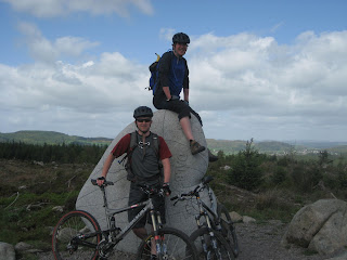
After doing the Upper Red again, the day finished off with a quick blast down the Orange Route. Aimed at freeriders it's got berms, tabletops and gaps jumps a-plenty. Not a lot of air being taken by our little party but plenty of opportunity if you've got the l33t skillz. And you'll need them, as we came across someone sparkled out at the bottom of the trail waiting for a ride in the local ambulance.

Summary
Highlight: Minimal up yet somehow maximum down.
Lowlight: The majority bottling out of Air's Rock
Summary: A brilliant, short, snappy, multiple-routes-in-a-day ride
Ride Rating: 9

Stats
Date: 05/06/09
Pedaling time: 2hr 36min
Distance: 23.6km
Max speed: 34.5km/h
Total ascent: 969m
Total descent: 958m
Puncture count: 0 (but breaking a chain made up for it)
Bike shop: BaseCamp MTB are on site at the start/end of the trails
Cafe: BaseCamp Cafe is right next door to the bike shop
Riders: DH, RI and AS

Driving from Glasgow
Distance: 121 miles
Travel time: 2 hours 47 mins
Directions: Multimap

Links
The shop and cafe at Wolftrax come courtesy of BaseCamp.
Laggan Wolftrax on the Forestry Commision's wesbite.

Sunday, June 7, 2009

Holiday in the Highlands

The first week of June saw some beautiful sunny weather giving us a taste of the summer ahead. Needless to say, that all changed for The Rusty Chain's weekend away in the Cairngorms. Pitching a tent is so much fun when its chucking it down.


Anyway the plan went like this:
  • Friday - Laggan Wolftrax
  • Saturday - Cross country from Rothiemurchus
We stayed at the Rothiemurchus campsite which has nice pitches among the pines, great showers and is only 5 minutes in a cab from the nighlife of Aviemore. Despite the rain for a good chunk of our stay we actually managed to miss most of it when on the bikes which was a real bonus.

The rides have been added as separate posts (Laggan Wolftrax, Loch Morlich and TBC) but a weekend to do a couple of days cycling in the area is thoroughly recommended, even if Aviemore on a Saturday night has come over all Blackpool with annoying stag parties.

Monday, June 1, 2009

Loch Katrine Circular

Route
Not too sure how this was ridden, because in a break with tradition it was... on road.


Review
Highlight: Car-free tarmac road for about 12miles on the north shore of the loch
Lowlight: The Duke's Pass climb
Summary: Excellent all rounder for the road toad
Ride Rating: 7/10


Stats
Date: 01/06/09
Pedaling time: 3hr-ish
Distance: 28.9miles
Max speed: ?
Total ascent: 4891ft
Total descent: 4902ft
Puncture count: 0
Riders: DH
Bike shop: ?
Cafe: ?

Driving from Glasgow
Distance: 30 miles
Travel time: 45 mins
Directions: ?

Sunday, May 17, 2009

Ardgartan Loop

Route
Take a look at the interactive map with GPS captured route and photos courtesy of Messrs. Google, Holux and Canon.


Or why not get a handy map of the route to print out and take with you?

Review
Highlight: Good length of forest road down at the end
Lowlight: The slog up towards the Rest and Be Thankful
Summary: A good ride to build the fitness up
Ride Rating: 6/10

As a wee bonus, here's some of the singletrack footage from the on-bike video camera.


Stats
Date: 17/05/09
Pedaling time: 3hr 7min
Distance: 35km
Max speed: 47km/h
Total ascent: 1096m
Total descent: 1117m
Puncture count: 1
Riders: DH and AS

Driving from Glasgow
Distance: 45 miles
Travel time: 1 hour
Directions: Multimap

Links
Ardgartan by the Forestry Commision, Visit Scotland and Wikipedia
Lochgoilhead on Wikipedia

Saturday, May 2, 2009

Dalbeattie

Route
No GPS mapping was done for this route but you can always grab the official 7 Stanes trail map.


Review
Highlight: The Slab
Lowlight: No cafe at the end
Summary: Great variety of natural and man-made terrain with something for everyone
Ride Rating: 9/10

Here's some video of bottling the Slab and going over the Terrible Twins.


Stats

Date: 02/05/09
Pedaling time: ?
Distance: ?
Max speed: ?
Total ascent: ?
Total descent: ?
Puncture count: 2
Riders: SC, DH and AS

Driving from Glasgow
Distance: 95 miles
Travel time: 2 hours 10 mins
Directions: Multimap

Links

Wednesday, April 1, 2009

Glen Ample

Route
An oldie so there's not many ride stats but here's a route guide to take a look at and print out.

Review
Highlight: Some nice singletrack
Lowlight: Maybe a touch too much Landrover trail, and it's much more fun going out than back
Summary: A nice wee ride, not too far from the 'Gow. You can either come back down the main road or via the Sustrans' cycle path to Callander. It's recommended that you either start from Callander or from one of the car parks on the east side of Loch Lubnaig.
Ride Rating: 7/10

Stats
Date: ?
Pedaling time: ?
Distance: 20 miles
Max speed: ?
Total ascent: ?
Total descent: ?
Puncture count: ?
Riders: DH, SC, RI and AS

Driving from Glasgow
Distance: 40 miles
Travel time: 1 hour
Directions: Google Maps

Links
Here's what Wikipedia has to say about Callander

Kirroughtree

Route
Get the 7 Stanes trail map from here.

Review
Highlight: Huge slabs and ridges of exposed granite, linked by boulder causeways? It's got to be McMoab.
Lowlight: ?
Summary: As the Forestry Commision says, it's home to some of the best technical singletrack in the country including the legendary McMoab for which skill and nerve is mandatory.
Ride Rating: ?

Stats
Date: ?
Pedaling time: ?
Distance: ?
Max speed: ?
Total ascent: ?
Total descent: ?
Puncture count: ?
Riders: RI and SC

Driving from Glasgow
Distance: 111 miles
Travel time: 2 hours 38 mins
Directions: Multimap

Links
Here's what the 7 Stanes site has on Kirroughtree.

Route Locations


View biking in a larger map